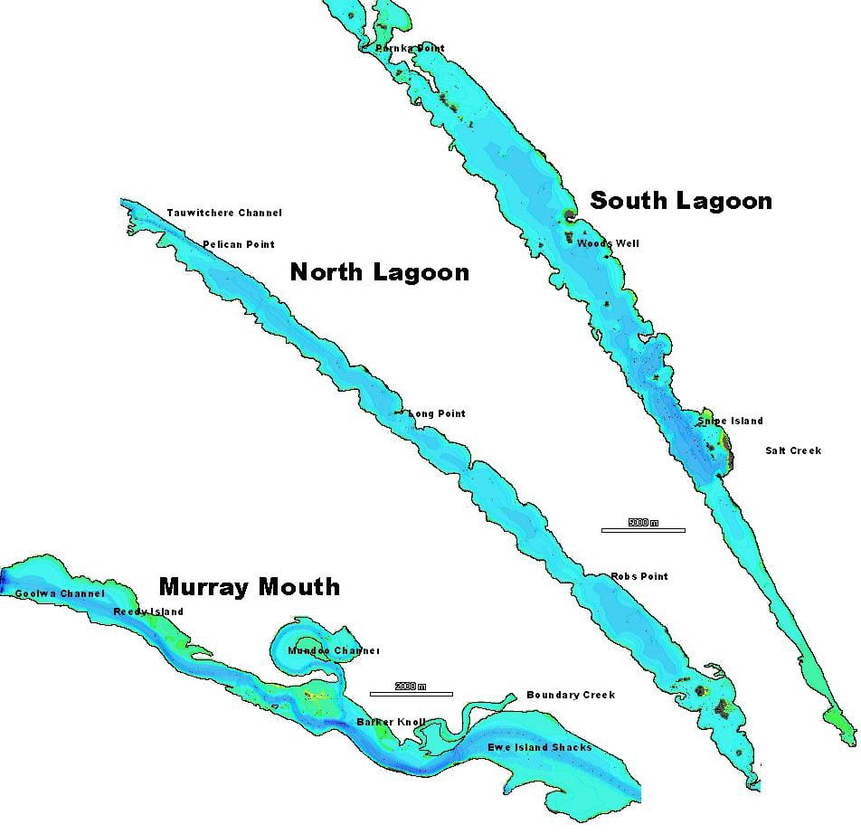
The most northern point of the Lakes and Coorong wetland complex is just 75km from the South Australian state capital of Adelaide, at the mouth of the River Murray. The site encompasses Lakes Alexandrina and Albert, the lower reaches of Currency Creek and Finniss River, the North and South Lagoons of the Coorong , along with a number of ephemeral saline lakes, mainly at the southern end.
The Lakes and Coorong wetland complex is a vast wave dominated estuarine system, located at the mouth of Australia's longest river, the River Murray. To drive from Goolwa at the north-western end, to the south-eastern extent of the ephemeral lagoons, just north of Kingston SE, is more than 250km. The two great lakes, Lakes Alexandrina and Albert have been separated from the Coorong by a series of man-made barrages, installed to keep saltwater out of the lakes and regulate water level.

The Coorong itself is 140 km long coastal lagoonal estuary, divided into two (North and South Lagoons) by Parnka Point, human-modified coastal lagoonal estuary in South Australia. This low-flow, often hypersaline estuary receives water inputs from a diversity of sources, including the River Murray, marine water influx, localised groundwater discharge, Salt Creek and a number of smaller-order catchments .


The wetland complex is the country of a diverse group of Traditional Owners, including a collective group of clans known as the Ngarindgeri (the people). Prior to European settlement, the Traditional Owners lived in semi-permanent and permanent dwellings and remarkably high population densities due to the natural productivity of the landscape. The first documented visit to the Coorong by Europeans occurred in the 1830s. During the first seventy years of European colonisation, the Coorong and affiliated wetlands were widely considered the premier fishing and hunting region of Australia, with early concerns being expressed in the 1920 with regard to declining wildfowl and fish populations. Despite the remoteness of the site, management of the estuary was rife with competing interests. Each activity within the estuary and catchment impacted (and continues to impact) the estuary in a parallel rather than sequential manner, making the impact of individual activities difficult to quantify, without careful and non-partisan analysis of the data available.
